


Technical Specification
Dimension
9.9"W x 7.8"H x 1.2"D (25.2 x 19.9 x 3.1 cm), device only 11.4"W x 7.6"H x 2.5"D (29 x 19.3 x 6.4 cm), device and dock
Weight
32.8 oz (930 g), device only 58.8 ounces (1666.5g), device and dock
Water rating
IPX7
Display Type
multi-touch, glass, high brightness HD color TFT with white backlight
Display Size
8.5"W x 5.3"H (21.7 cm x 13.6 cm); 10.1" diagonal (25.7 cm)
Display resolution
1280 x 800 pixels
Dual-orientation display
yes
Magnetic Mount
locking magnet-assisted mount
Mount type
bail mount
1.5" ball adapter with AMPS plate
yes
Drop rating
MIL-STD-810
Dust rating
IP6X
Battery Type
rechargeable lithium-ion
Battery life
Up to 6 hours at 50% backlight Up to 1 hour at 100% backlight
Compatible with Tread XL Baja Dock accessory
yes (included)
Data cards
microSD™ card (not included)
Preloaded street maps
yes
High Definition 3D terrain
yes
High Definition 3D terrain
yes
Internal storage
128 GB
Ability to add maps
yes
External memory storage
yes (256 GB max microSD™ card)
Includes map updates
yes
Downloadable Satellite Imagery
yes (BirdsEye)
BirdsEye Direct Satellite Imagery
yes
GPS
yes
Galileo
yes
Barometric altimeter
yes
Compass
yes
10hz multi-GNSS positioning
yes
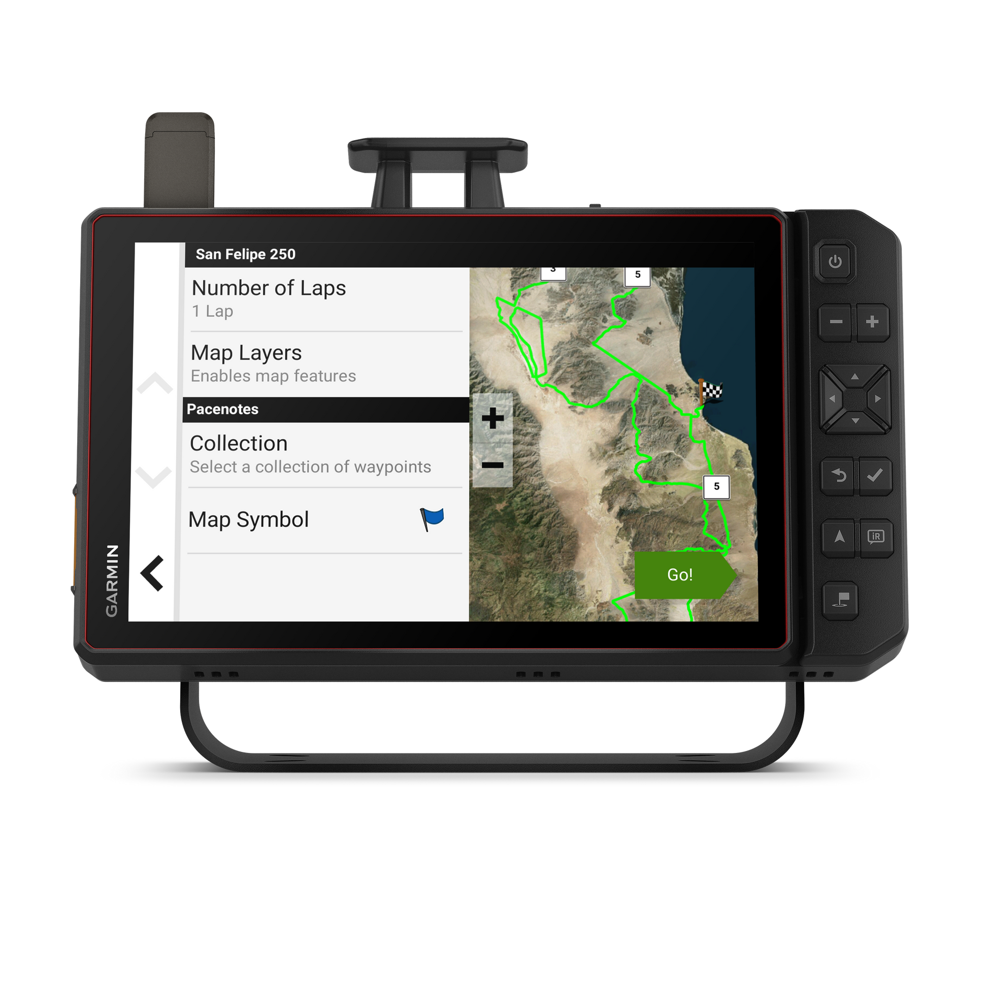
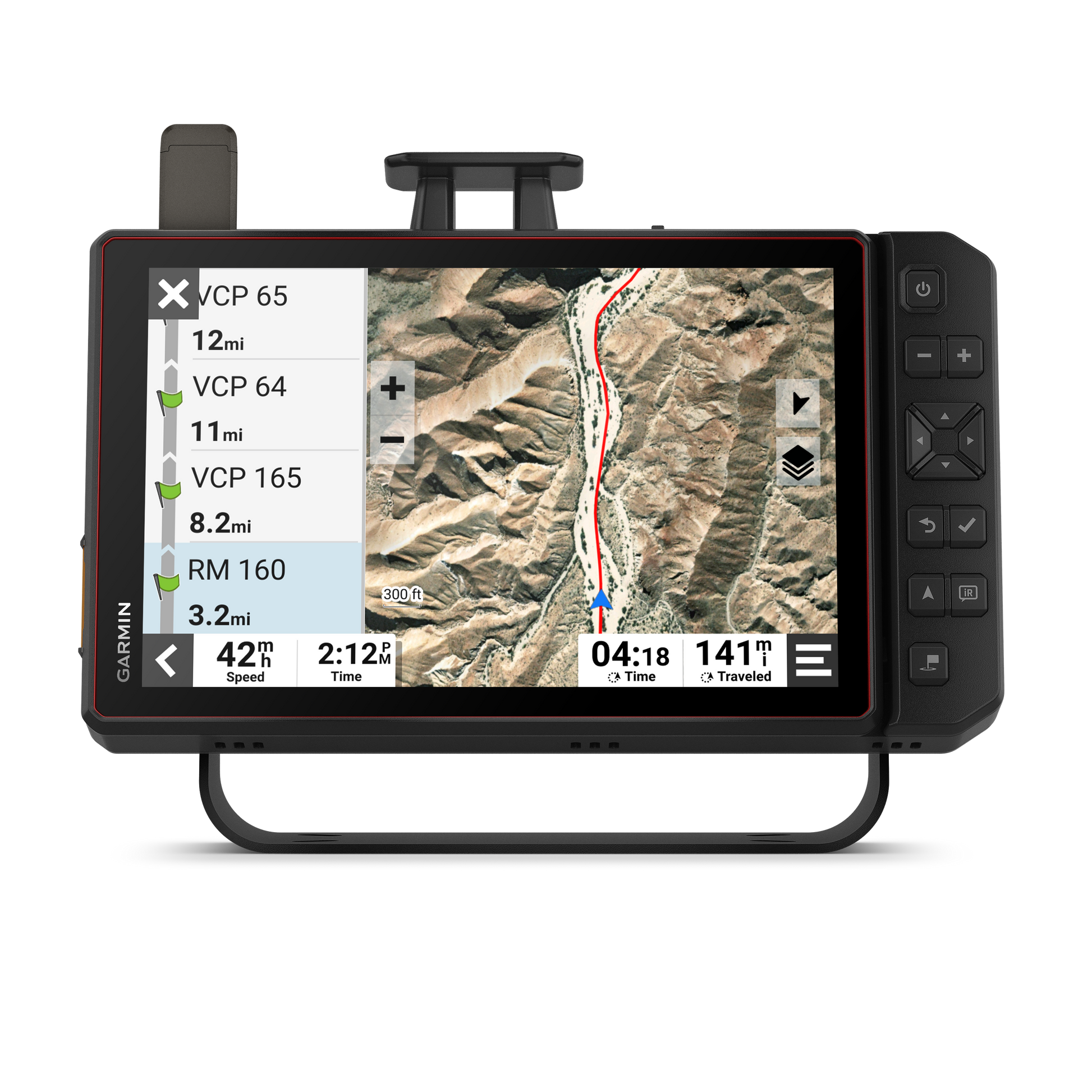
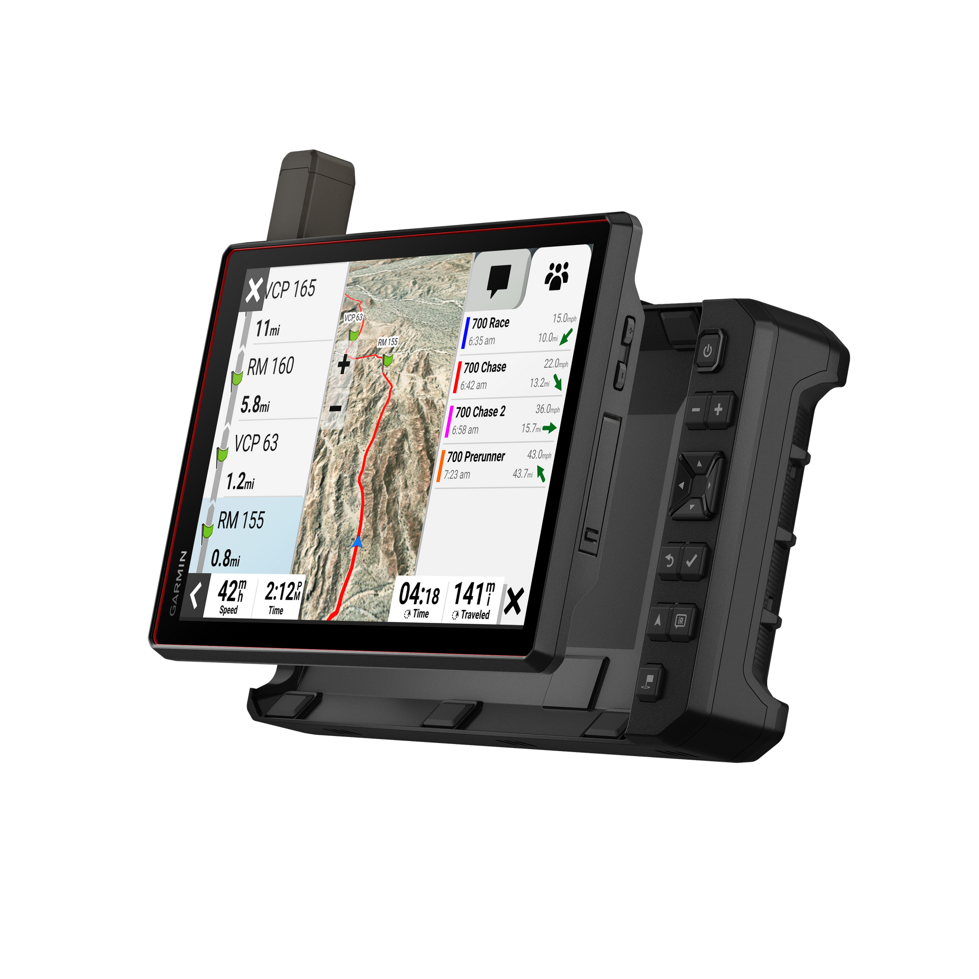
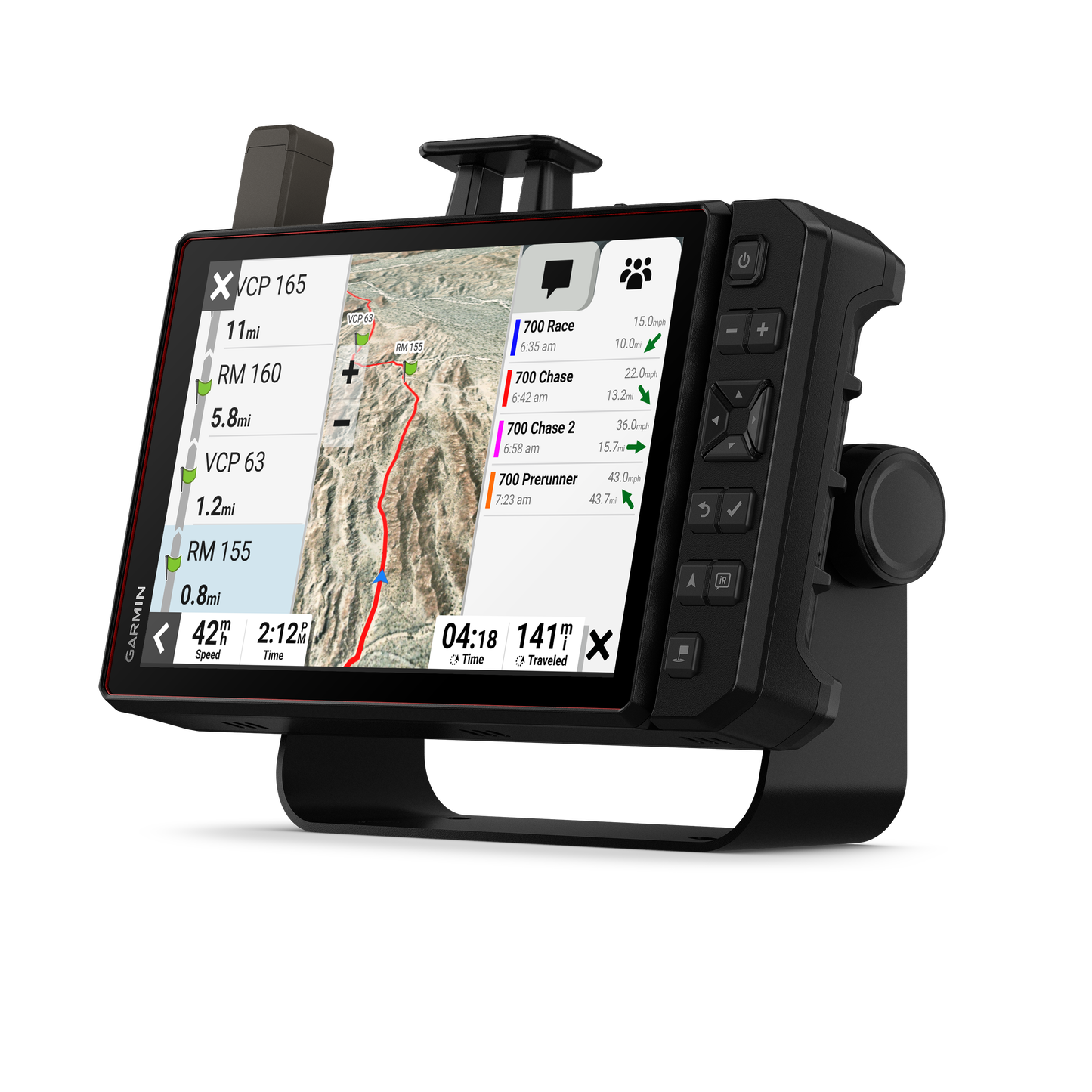
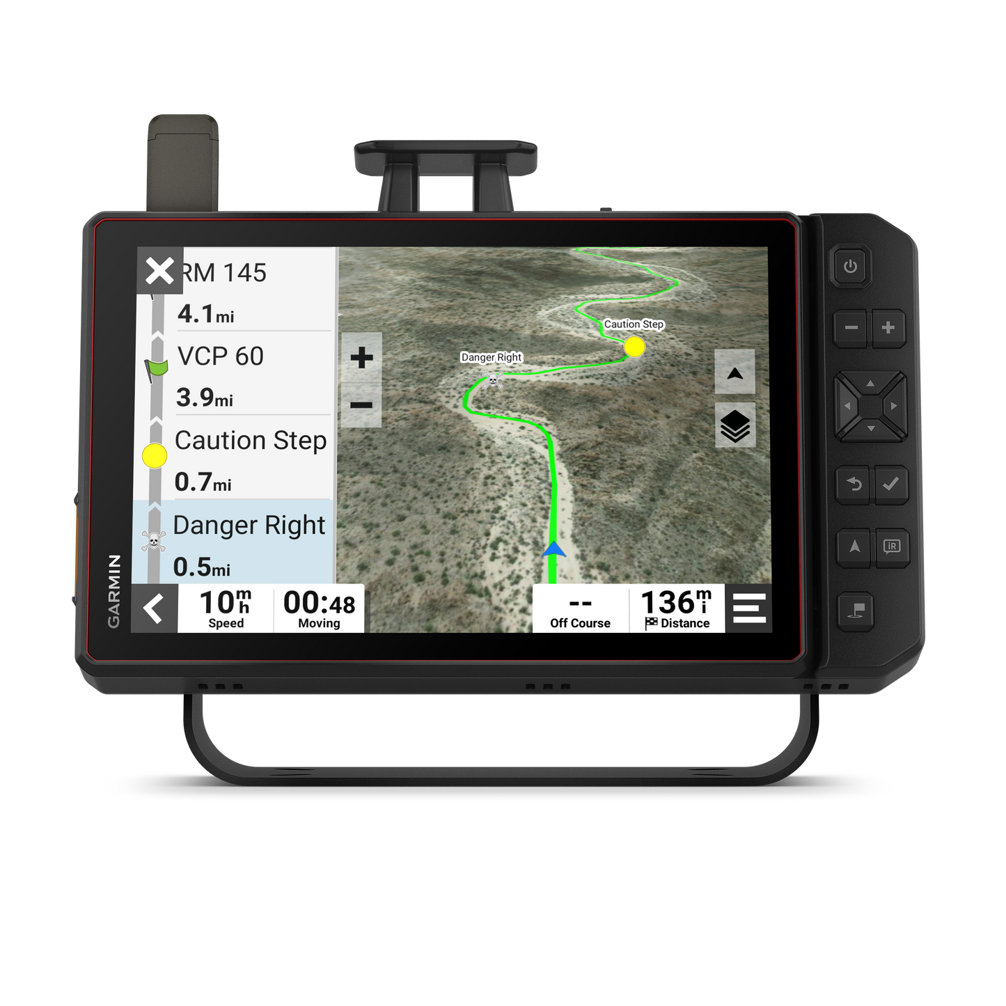
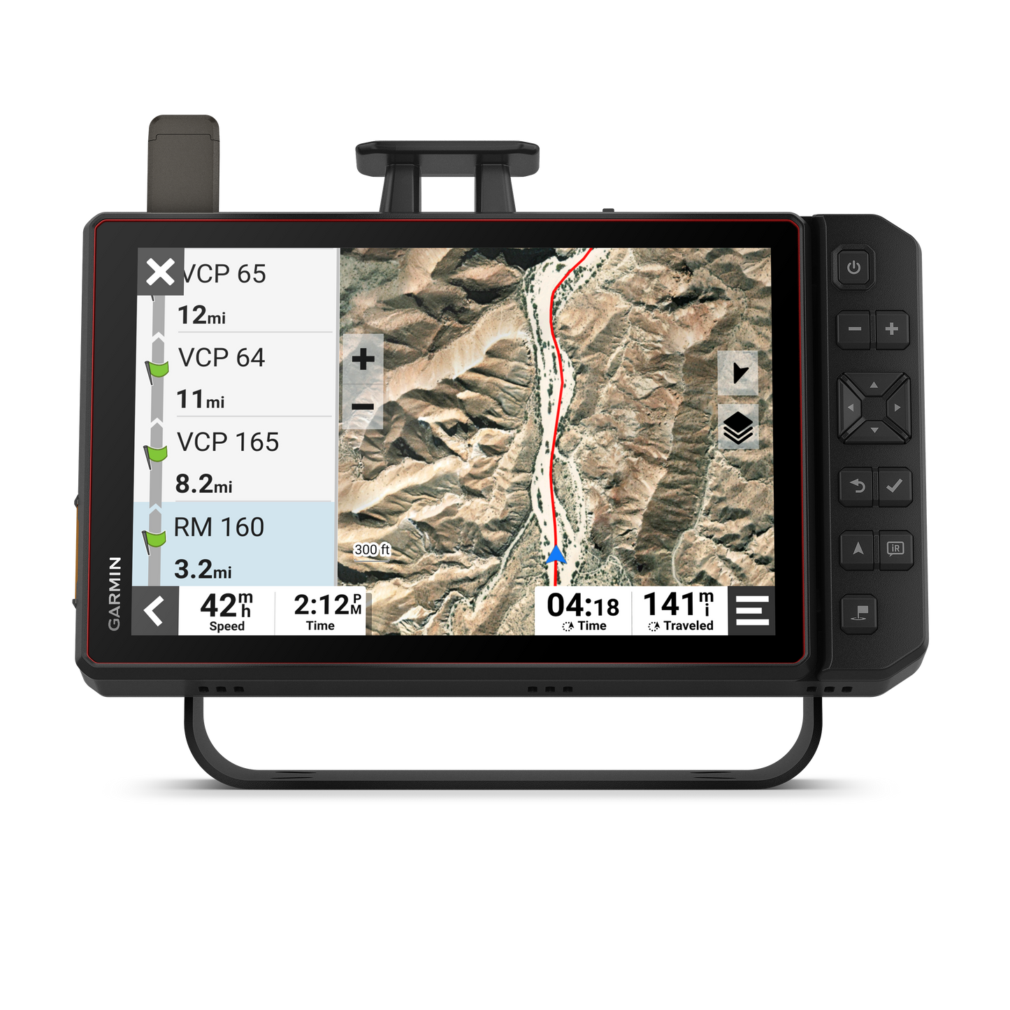
Point-to-point navigation
yes
Preloaded topographical maps
yes
Preloaded US public land boundaries
yes
Preloaded private land parcel maps
yes (parcels greater than 4 acres)
Preloaded USFS Roads and Trails, including motor-vehicle-use-maps for motorcycle, ATV, SXS and full-size 4x4
yes
Navigate-a-track navigation
yes
Turn-by-turn trail navigation
yes
Backup camera compatible
yes (BC™ 50)
Wi-Fi® map and software updates
yes
Built-in inReach® Technology (requires active subscription; subject to regulations or prohibitions in some jurisdictions)
yes
Pair with Garmin PowerSwitch™ digital switch box
yes
Compatible with Group Ride Radio
yes
Compatible with external GPS antenna with mount
yes (included)
Compatible with external inReach® satellite antenna
yes (included)
Group Ride Mobile
yes (with Garmin Tread app)
Track recorder (breadcrumbs)
yes
iOverlander™ points of interest
yes
Ultimate Public Campgrounds
yes
Birdseye Satellite Imagery (download via Wi-Fi)
yes
Glove-friendly touchscreen
yes
No Documentation available.